


In modern land surveying, precision is everything. Whether you are working on infrastructure development, construction layout, or boundary verification, understanding Robotic Total Station Accuracy Explained for Survey Professionals is essential for producing reliable and defensible results in the field.
This article breaks down how robotic total stations achieve their accuracy, what factors influence measurements, and how survey professionals can maximize performance in real-world conditions.
Understanding Robotic Total Stations
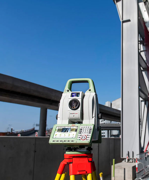
A robotic total station is an advanced surveying instrument that combines electronic distance measurement (EDM), angular measurement, and automated target tracking. Unlike conventional total stations, robotic models can be operated remotely by a single surveyor using a controller.
These systems rely on motorized drives and optical tracking to lock onto a prism and follow it as it moves across a site. This automation reduces manpower needs and increases efficiency, especially in large or complex projects.
At the core of Robotic Total Station Accuracy Explained for Survey Professionals is the ability of these instruments to maintain millimeter-level precision while tracking dynamic targets in real time.
Key Components That Influence Accuracy
To understand accuracy, it is important to look at the internal systems that make robotic total stations so precise:
1. Angular Measurement System
Robotic total stations use high-resolution encoders to measure horizontal and vertical angles. Even minor angular errors can translate into significant positional inaccuracies over long distances.
2. Electronic Distance Measurement (EDM)
The EDM system calculates distance using infrared or laser signals. Environmental conditions such as temperature, humidity, and atmospheric pressure can slightly affect signal speed and must be accounted for.
3. Prism and Reflector Quality
The type of prism used and its alignment directly influence measurement precision. High-quality prisms ensure consistent reflection and reduce signal distortion.
4. Calibration and Instrument Condition
Regular calibration ensures that mechanical and optical components remain aligned. A poorly maintained instrument can drift from its factory accuracy specifications.
These elements collectively define how well Robotic Total Station Accuracy Explained for Survey Professionals translates from theory into field performance.
Factors Affecting Field Accuracy
Even the most advanced robotic total stations can experience reduced accuracy in real-world environments. Survey professionals must be aware of the following factors:
Environmental Conditions
Heat shimmer, fog, dust, and rain can interfere with laser signals and optical tracking. Atmospheric refraction can also distort measurements over long distances.
Line of Sight Limitations
Obstructions such as trees, vehicles, or construction equipment can interrupt prism tracking, causing temporary loss of lock or reduced precision.
Operator Setup Errors
Incorrect instrument leveling, poor tripod stability, or improper prism height entry can introduce significant errors before measurement even begins.
Distance and Range
Accuracy typically decreases as the distance between the instrument and prism increases. Keeping measurements within optimal range improves consistency.
Understanding these limitations is crucial when applying Robotic Total Station Accuracy Explained for Survey Professionals in practical fieldwork.
Best Practices for Maximizing Accuracy
Survey professionals can significantly improve results by following proven field procedures:
Proper Instrument Setup
Always ensure the total station is perfectly leveled and securely mounted. Even slight tilting can introduce angular deviations.
Regular Calibration Checks
Routine calibration and instrument checks help maintain manufacturer-specified accuracy levels over time.
Use of High-Quality Prisms
Consistent use of compatible prisms reduces variability in distance measurements and improves tracking stability.
Environmental Awareness
Avoid taking critical measurements during extreme weather conditions or when heat distortion is visible.
Redundant Measurements
Taking multiple readings and averaging results helps identify and eliminate random errors.
Applying these practices ensures that Robotic Total Station Accuracy Explained for Survey Professionals is not just theoretical knowledge but a reliable field standard.
Applications in Modern Surveying
Robotic total stations are widely used across various industries due to their precision and efficiency:
- Construction layout and staking
- Road and highway alignment
- Bridge and tunnel monitoring
- Topographic mapping
- Structural deformation analysis
In each of these applications, accuracy directly impacts safety, cost, and project success. That is why understanding Robotic Total Station Accuracy Explained for Survey Professionals is so important for engineers and surveyors working in high-precision environments.
Conclusion
Robotic total stations represent a major advancement in surveying technology, combining automation with high-precision measurement systems. However, their true performance depends on proper setup, environmental awareness, and skilled operation.
By mastering Robotic Total Station Accuracy Explained for Survey Professionals, surveyors can ensure reliable data collection, reduce costly errors, and improve overall project efficiency.
